Cooperative Guidance Navigation and Control

In this project, we aim to create an cooperative localization framework through which a team of robots can share information (eg. range, bearing, pseudo-range etc.) between themselves to allow them to update their positions to be consistent with one another. While similar work as been done in this field, we are looking to develop techniques where the data shared between agents are limited and where communication is more sparse. Another area of interest for our research group is to optimize guidance laws for obtaining
Visual Odometry

AVL is has experience using a varied of vision based sensors including RGB-D camera, event cameras to solve the problem of GPS denied autonomy for both an indoor and outdoor environment. Our lab uses generally used visual odometry as part of a larger navigation stack and have generated our own in-house generic VO algorithm. Additionally, we have extensively explored the problem of uncertainty quantification in VO algorithms to improve filter consistency as part of this work.
Magnetic Anomaly Based Navigation

Magnetic Anomaly based navigation is similar to terrain-based navigation but uses the Earth’s magnetic to navigate and localize an agent. This problem has been of great interest to the Air Force Research Lab as it is a passive sensing technique and does not rely on weather and visual features. The AVL has supported AFRL in developing simplified proof-of-concept demonstrations using a ground robot and a magnetic anomaly map of our flight space (available to public on request) to support researchers and engineers. From a research stand-point, AVL is interested in exploring information based guidance for MagNav and the applying machine learning for the problem of own-ship calibration.
Pose-Graph Optimization for GPS Denied Navigation

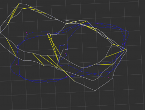
Developing a frontend-backend framework for GPS denied guidance navigation and control of autonomous agents. In this work we are developing a frontend EKF which produces delta-pose like odometry measurements w.r.t a local reference and a backend pose-graph which optimizes over the odometry measurements and also incorporates loop closures and intermittent GPS measurements to produce a globally consistent map. Separating the frontend insulates flight-critical estimation and control processes which happen at a right rate from the large global update which is used for guidance. We are interested in developing a simple and easy to use system which can work for a large number of sensors and on a wide variety of robotic platforms. We also aim to demonstrate the ability of the system to work on both an indoor and outdoor environment.